Via Transilvanica
A long-distance trail that crosses Romania on a diagonal, from Putna Monastery in Bucovina to Drobeta-Turnu Severin on the Danube.
At a glance
- Starts in
- Putna Monastery
- Ends in
- Drobeta-Turnu Severin, Danube bank by the ruins of Trajan's Bridge
- Length
- 1,600 km
- On foot
- ≈ 64–80 days
- Countries
 Romania
About the trail
Via Transilvanica was conceived by the Tășuleasa Social association as a road that would tie together the historic regions of Romania. It begins at Putna Monastery in Bucovina, burial place of Stephen the Great, and runs south-west through the hills and villages of Transylvania to the Danube at Drobeta-Turnu Severin, where the stumps of a Roman bridge still stand in the river.
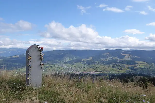
The route is divided into themed regions with Latin names, among them Terra Siculorum, Terra Saxonum, Terra Dacica and Terra Banatica, which follow the country's cultural layers: Székely villages, Saxon towns with fortified churches, Dacian heartlands and the Banat uplands. Much of the walking is on farm tracks, forest roads and old village lanes rather than high mountain paths, and each kilometre is marked by a carved andesite milestone bearing the trail's T symbol.
The association now gives 1,600 km divided into 85 stages, after an extension that began in 2025, and it publishes no fixed number of days. Most people walk it in sections between villages with guesthouses, following orange T waymarks; a full crossing is a matter of months rather than weeks.
No source gives the days on foot, so they are worked out from the length at 20–25 km a day.