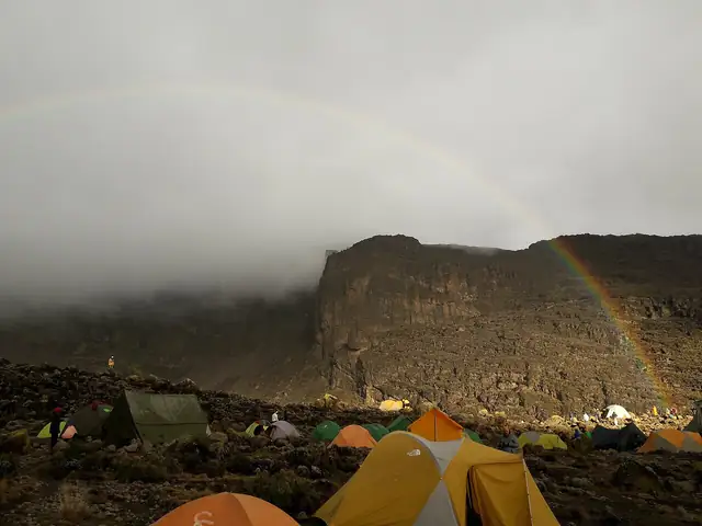
Kilimanjaro Umbwe Route
Umbwe Route
- UNESCO World Heritage
The most direct and steepest way up Kilimanjaro, climbing from Umbwe Gate on the southern slopes through rainforest to join the southern circuit below Kibo.
At a glance
- Starts in
- Umbwe Gate
- Ends in
- Uhuru Peak
- Length
- 26 km
- On foot
- ≈ 1 day
- Countries
 Tanzania
- Best months
- December–February and July–September
About the trail
Kilimanjaro National Park, declared a UNESCO World Heritage Site in 1987, protects the highest mountain in Africa, and the Umbwe route is the most direct of its ascents from the south. It starts at the Umbwe Gate, reached by road, and climbs a narrow forested ridge between deep river valleys towards the Barranco valley below the Western Breach.
Because it gains height so quickly, the route leaves little time for acclimatisation and is usually chosen by experienced climbers. Above the forest it joins the southern circuit also used by the Machame and Lemosho routes and follows it round to the final night climb to the crater rim and Uhuru Peak.
Tanzania National Parks lists Umbwe among the wilderness routes with designated campsites and toilets, and says that summit climbs take five to nine days depending on the route. The dry seasons, from late June to September and from December to early March, are the best times to go, and climbers on camping routes come down by Mweka Gate.
Length measured on the OpenStreetMap line; no official figure checked yet.
No source gives the days on foot, so they are worked out from the length at 20–25 km a day.