Kilimanjaro - Rongai Route
Rongai Route
- UNESCO World Heritage
The only route up Kilimanjaro from the north, starting near the Kenyan border and climbing the drier northern slopes to Uhuru Peak.
At a glance
- Starts in
- Rongai Gate
- Ends in
- Uhuru Peak
- Length
- 34 km
- On foot
- ≈ 1–2 days
- Countries
 Tanzania
- Best months
- December–February and July–September
About the trail
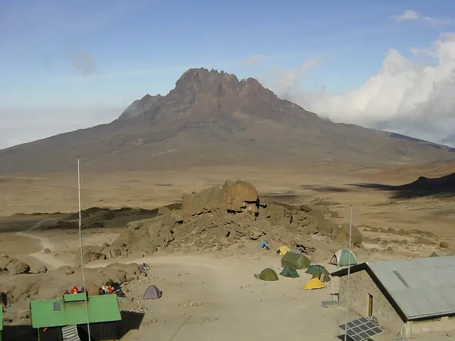
The Rongai route starts on the north side of Kilimanjaro, close to the border with Kenya, and is the only route that climbs the mountain from that direction. The northern slopes lie in the mountain's rain shadow, so the forest belt is narrower and the weather often drier than on the southern routes.
From the gate the trail climbs through forest and heath with long views back over the plains, then crosses open alpine country between the peaks of Mawenzi and Kibo. On the final stage it meets the Marangu route at Kibo hut for the night climb to the crater rim and Uhuru Peak.
Tanzania National Parks lists a Rongai gate on the north side of the park, says summit climbs take five to nine days depending on the route, and names the dry seasons from late June to September and from December to early March as the best times. Climbs are run as camping trips through licensed operators.
Length measured on the OpenStreetMap line; no official figure checked yet.
No source gives the days on foot, so they are worked out from the length at 20–25 km a day.