Fuerteventura Nature Trail
Camino Natural de Fuerteventura (GR 131)
The GR 131 across Fuerteventura, a 153 km Nature Trail from the islet of Lobos and Corralejo in the north to Punta de Jandía in the south, through volcanic badlands, sandy plains and the old capital Betancuria.
At a glance
- Starts in
- Corralejo harbour (ferry from Isla de Lobos)
- Ends in
- Punta de Jandía
- Length
- 153 km
- On foot
- ≈ 6–8 days
- Countries
 Spain
About the trail
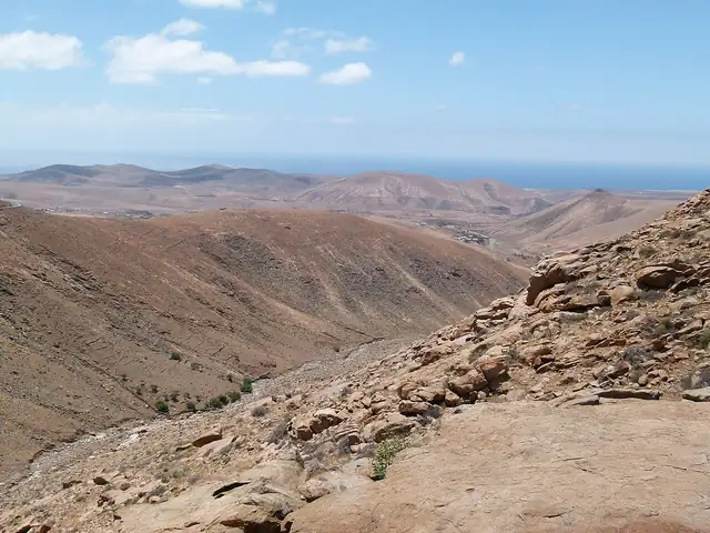
Fuerteventura was declared a UNESCO Biosphere Reserve in 2009, and the GR 131 crosses the whole island from north to south. The route begins with a walk across the islet of Lobos to its Martiño lighthouse, passes volcanic cones, calderas and the Malpaís de la Arena between Corralejo and La Oliva, and continues by Tindaya, a mountain held sacred by the island's original inhabitants, to Betancuria, the historic capital.
Further south the trail crosses golden sand and volcanic badlands into Jandía Natural Park, where a branch climbs Pico de la Zarza, the island's highest point. The last section leads from Morro Jable to Punta de Jandía at the southern tip of the island.
Spain's Ministry of Agriculture, Fisheries and Food, which runs the Nature Trails programme, gives 153 km for the main route in nine sections, with thirteen shorter trails adding 97 km. It advises against walking at midday in summer and describes mostly gentle gradients, with exceptions such as the climb to Pico de la Zarza and the Cifete cliffs.
No source gives the days on foot, so they are worked out from the length at 20–25 km a day.
Sources
- https://www.mapa.gob.es/en/desarrollo-rural/temas/caminos-naturales/caminos-naturales/sector-canario/fuerteventura/default.aspx
- https://servicio.mapama.gob.es/en/desarrollo-rural/temas/caminos-naturales/Fuerteventura-EN_tcm38-140470.pdf
- https://servicio.mapama.gob.es/en/desarrollo-rural/temas/caminos-naturales/canarias_en_web_tcm38-420330.pdf