Villarrica Traverse
Travesía del Villarrica
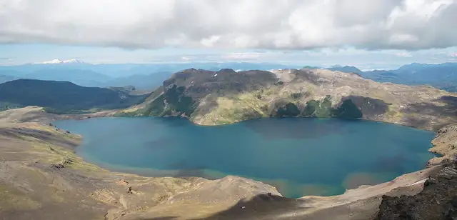
A difficult multi-day crossing of Villarrica National Park in Chile's Araucanía region, from the slopes of the active Villarrica volcano above Pucón eastwards towards Puesco near the Argentine border.
At a glance
- Starts in
- Rucapillán sector, above Pucón
- Ends in
- Puesco sector
- Length
- 47 km
- On foot
- ≈ 2 days
- Countries
 Chile
About the trail
Villarrica National Park was created on 28 November 1940 and protects 53,460 hectares of volcanic country in Chile's Araucanía region, including the active Villarrica volcano above Pucón. The traverse crosses the park from the slopes of Villarrica eastwards over high volcanic ground and through native forest towards the Puesco sector near the border with Argentina.
CONAF lists the Travesía del Villarrica as a difficult route of 46.5 km and warns of rockfall, and of mudflows in the event of an eruption between December and April. It also lists shorter linking trails in the park, such as Chinay to Challupén, 19.5 km one way.
No source gives the days on foot, so they are worked out from the length at 20–25 km a day.