Takashima Trail
高島トレイル
An 80 km ridge walk along Japan's main watershed on the north-western rim of Shiga Prefecture, where the waters that feed Lake Biwa begin.
At a glance
- Starts in
- Arachigoe, Kunizakai Kogen (Makino)
- Ends in
- Kutsuki, Kuwabara-bashi below Mikunidake
- Length
- 80 km
- On foot
- ≈ 3–4 days
- Countries
 Japan
- Best months
- May–November
About the trail
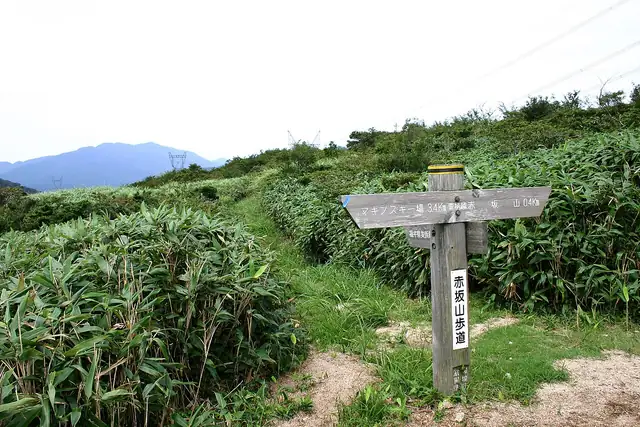
The Takashima Trail follows the Chūō Bunsuirei, the main watershed of Japan, along the mountains of Takashima in north-western Shiga Prefecture, where the water that feeds Lake Biwa begins. Old roads between the Wakasa coast and the capital crossed this ridge, and the trail meets at least 12 major passes, among them those of the Saba Kaidō, the 'mackerel road' by which fish from Wakasa were carried to Kyoto.
It begins at Arachigoe in Makino, a pass on the Hokuriku road that was already one of Japan's main arteries in the Heian period, and runs south-west over a chain of wooded summits to Mikunidake above Kutsuki. The highest point is Sanjōgatake at 974.1 m and the lowest the Misaka pass at 280 m.
The trail's official website splits the route into 12 sections that can be walked as day hikes, or walked end to end with a tent. Snow usually melts before the early May holidays, the first snow falls in late November or early December, and the deepest snow lies from late January to early March.
Nearby trails
No source gives the days on foot, so they are worked out from the length at 20–25 km a day.