Laurel Highlands Hiking Trail
A 70-mile ridge trail along Laurel Mountain in south-western Pennsylvania, from the Youghiogheny River at Ohiopyle to the Conemaugh Gorge near Johnstown, with eight shelter areas on the way.
At a glance
- Starts in
- Ohiopyle
- Ends in
- Conemaugh Gorge near Seward
- Length
- 113 km
- On foot
- ≈ 5–6 days
- Countries
 United States
About the trail
The Laurel Highlands Hiking Trail follows Laurel Mountain in south-western Pennsylvania for about 70 miles. It starts on the banks of the Youghiogheny River in Ohiopyle State Park and ends above the Conemaugh Gorge, a cut about 1,000 feet deep near Johnstown, crossing state parks, state forests, state game lands and private land on the way.
The trail is the main feature of Laurel Ridge State Park and a major segment of the Potomac Heritage National Scenic Trail, whose highest point, at 2,994 feet, lies on this ridge. Yellow blazes and mileage monuments at every mile mark the route, blue blazes lead to connector trails, and in the section north of Route 653 the path crosses the ski area at Seven Springs.
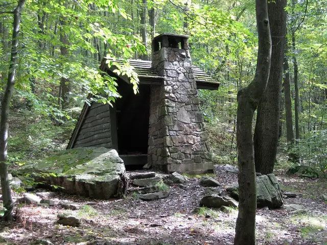
The Pennsylvania Department of Conservation and Natural Resources lists eight overnight shelter areas, one every six to 12 miles, which must be reserved in advance and charge a fee per person per night. The National Park Service names them as Ohiopyle, Route 653, Grindle Ridge, Route 31, Turnpike, Route 30, Route 271 and Decker Avenue, each with shelters, a fire ring, water and privies, and the trail is open all year.
No source gives the days on foot, so they are worked out from the length at 20–25 km a day.